|
|
Home |
|
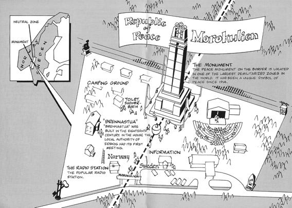
This map shows Morokulien before the alterations (road reconstruction, new tourist bureau) took place in the 80ies. At that time the tourist bureau (Information) was located next to the Värdshus (the inn). The road has later been shifted some metres and does pass a new bridge. The bridge is built across the national border. Underneath the bridge is a footpath to the new tourist bureau.
 |
Map taken from [1]) |
| Home |
|
Created: Sep 24, 2005, last modification: Oct 15,
2005 DL6BZ |